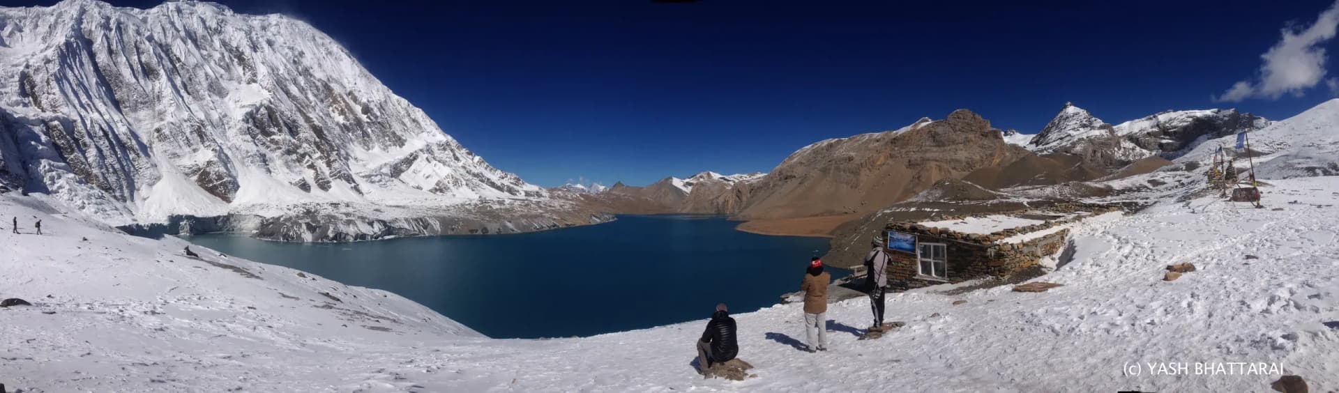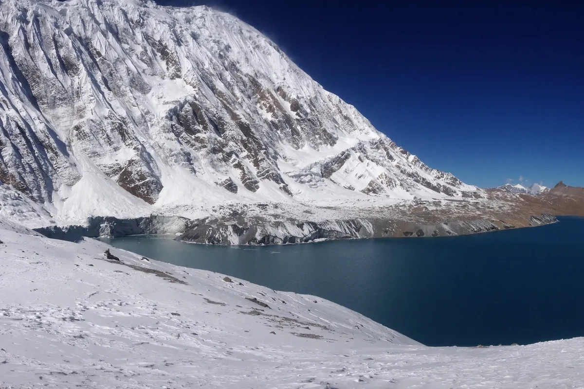
Tilicho Lake (Tilicho Tal) lies in Nepal's Manang district, within the Annapurna Conservation Area. LHJ uses about 4,919 m for route planning, although official publications also give 4,949 m. Reaching the lake involves a walking approach through the Khangsar valley and a high day from Tilicho Base Camp. Road access into the valley changes where you begin walking; it does not make the lake a roadside stop. NTNC's conservation-area overview identifies its location, and LHJ's Tilicho Lake Trek sets out the lake-and-return route.
The useful questions are where you can currently drive, where you will sleep, and whether the approach gives you enough time to adjust to altitude. This guide separates those decisions before you choose a departure or add Tilicho to an Annapurna Circuit trip.
Before you plan
- Use about 4,919 m as the planning figure, while recognising the published height disagreement explained below.
- Confirm the current road endpoint and trail conditions. A photograph or an old itinerary cannot establish either.
- Read the overnight stops as carefully as the lake's high point. The lake visit and the sleeping-altitude progression are different things.
- Choose between returning down the Manang valley and continuing on the Annapurna Circuit before comparing total trip days.
Where is Tilicho Lake, and what is its altitude?
Tilicho is reached through Manang and the Khangsar side valley on LHJ's published approach. NTNC describes Tilicho as a freshwater lake in Manang, north of the Annapurna massif. The Annapurna region guide gives the wider setting. For other lake-focused routes, see LHJ's Lakes in Nepal collection.
The two heights you will encounter are 4,919 m (about 16,140 ft) and 4,949 m (about 16,240 ft). Both appear in official publications: NTNC's 2017 annual report, printed page 13, gives 4,919 m. The Nepal Tourism Board's Natural Treasures of Nepal booklet gives 4,949 m in its Tilicho section.
LHJ's current trek uses 4,919 m, so this guide uses about 4,919 m consistently. The cited publications do not establish why the figures differ. Treat it as a planning approximation, with the source disagreement acknowledged. Neither figure establishes a world-highest-lake ranking.
Khangsar road access: how far can you drive?
Khangsar is the road-access point recorded by LHJ on the Tilicho approach. Current vehicle access still needs checking for your dates. LHJ confirmed the Manang-to-Khangsar road connection in August 2026, and Khangsar is part of the separate Manang Valley road-trip route. Do not assume that a vehicle can reach the same stopping place in every season.
Ask the operator to name the actual drop-off point, what happens if the road is interrupted, and which part of the approach you will walk. "Drive to Manang" and "drive toward Khangsar" leave different amounts of walking, but neither describes the climb from Base Camp to the lake.
Also separate possible road access from the route your trek deliberately walks. LHJ's Tilicho itinerary walks from Manang to Khangsar after its Manang rest day. The fact that a road reaches farther into the valley does not mean every itinerary should use it. The Tilicho Lake Trek walking and driving plan is the place to check the actual walking and driving arrangement for the product you are considering.
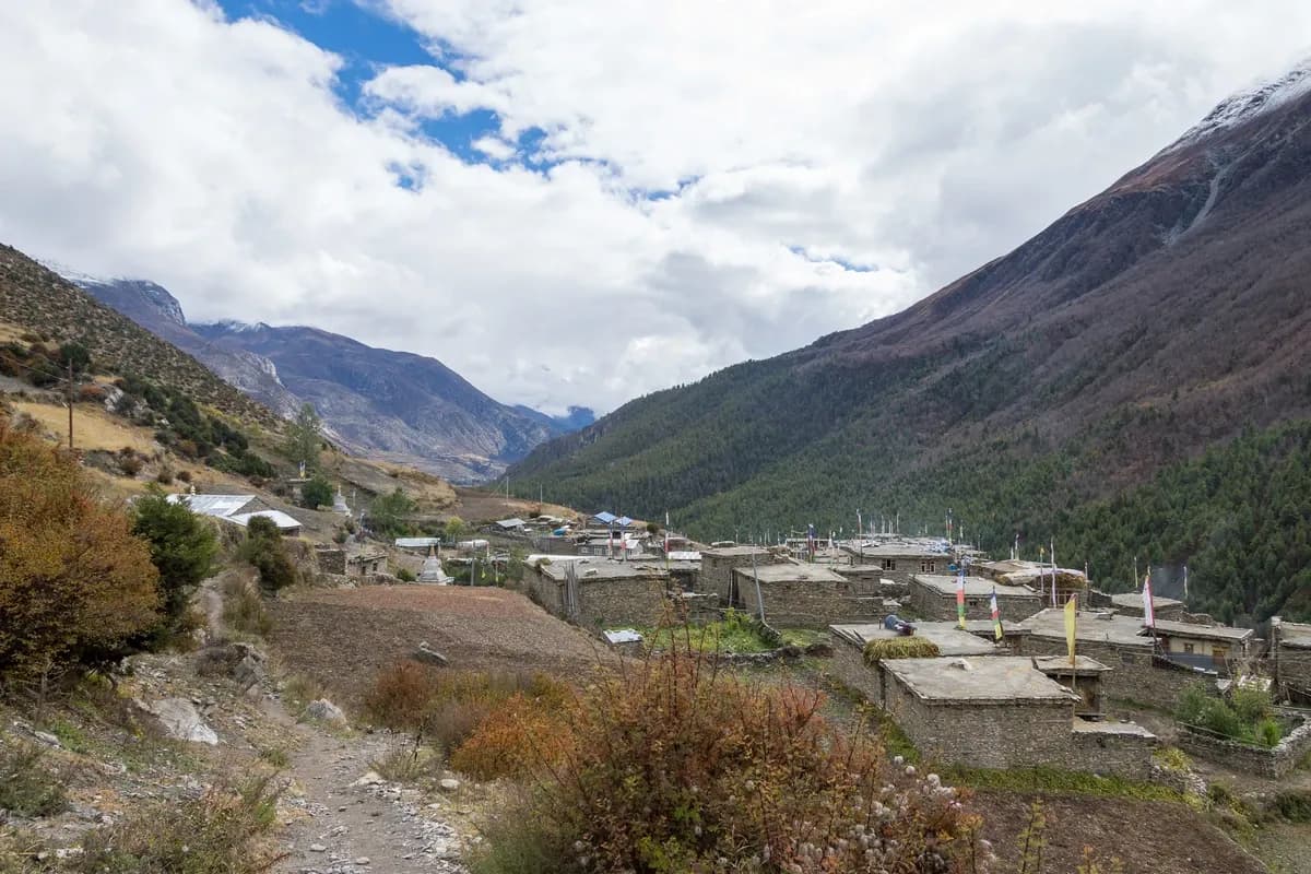
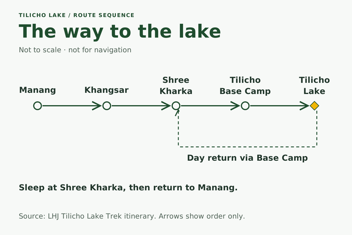
The walking route from Manang to the lake
The sequence is Manang, Khangsar, Shree Kharka, Tilicho Base Camp, then the lake. Shree Kharka also appears as Sri Kharka in LHJ's itinerary. The lake day returns downhill; on LHJ's published route, that night's stop is Shree Kharka. These are route-planning figures from LHJ's standalone Tilicho Lake Trek itinerary, rather than surveyed trail distances or guaranteed walking times.
| Stage in LHJ's published plan | Walking estimate | Overnight height |
|---|---|---|
| Manang rest/acclimatisation day | Optional activity depends on the day's plan and how you feel | About 3,540 m; another night at the same height |
| Manang to Khangsar | About 7 km / 3 hours | About 3,734 m |
| Khangsar to Tilicho Base Camp, via Shree Kharka | About 12 km / 5 hours | About 4,150 m |
| Base Camp to Tilicho Lake, then down to Shree Kharka | About 16 km / 8 hours for the complete stage | About 4,080 m; the lake is the daytime high point |
| Shree Kharka to Manang | About 14 km / 5 hours | About 3,540 m |
The table is a short excerpt from the published route, not a complete acclimatisation itinerary. The earlier approach matters. Walking times and distances depend on the endpoints used, conditions and the group's pace; confirm the current stages with the guide.
In particular, the 16 km figure includes the lake visit and the descent to the lower overnight stop. It is not the one-way distance from Base Camp to Tilicho Lake. These combined-stage figures also cannot establish a precise one-way Khangsar-to-lake distance. Ask for the intended route and endpoints when comparing a different distance estimate.
What is the landslide traverse like?
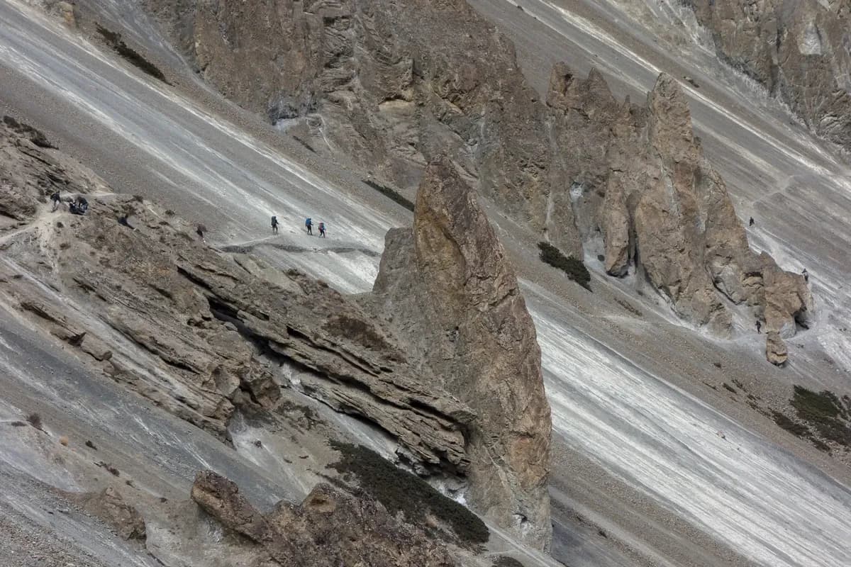
The approach to Tilicho Base Camp includes loose-slope terrain. LHJ's Tilicho approach description identifies the rockfall-prone section between Khangsar and Base Camp and describes a morning crossing preference with a daily guide decision on conditions.
That is a planning practice, not a promise that a particular hour makes the slope safe. The useful question is whether the section is suitable to cross on that day, including whether weather, snow or a changed trail affects the plan. A trip should allow the guide to wait, turn back or change the day's objective when necessary, rather than making the lake visit unconditional.
Before setting out, ask which trail line is currently in use and what the alternative is if the crossing is unsuitable. A historical photograph can help you understand the terrain. It cannot confirm the present trail surface, show that a repair is still intact or replace the guide's assessment.
Tilicho Base Camp and Shree Kharka: where do you sleep?
Plan a lower overnight stop and a day visit to the lake. Do not assume there is a lodge at the lakeshore. LHJ's published plan sleeps at Tilicho Base Camp, visits the lake, then descends to Shree Kharka. Other itineraries may return to Base Camp; compare the actual overnight location, not just the phrase "Tilicho Lake day". The Tilicho trek itinerary gives LHJ's overnight stops.
Base Camp and the lake are separate places. Using LHJ's approximate figures, Base Camp is around 4,150 m (about 13,620 ft) and the lake around 4,919 m. Reaching your lodge therefore does not mean you have reached the lake. The following morning still involves a high excursion and a return to your planned sleeping place.
LHJ's published lake-day description places the lake in a mountain basin and plans a pre-dawn departure to reach it before stronger afternoon wind. That is a planning choice, not a guaranteed calm or safe window; the weather and the guide's decision still govern the day.
Confirm that the intended lodge is operating and that the overnight arrangement works for your departure. An itinerary listing a settlement is not a bed reservation or a guarantee that its lodges stay open all year.
For an overnight camp, ask the operator to explain the specific campsite, permissions, equipment and support. That is a different arrangement from the lodge-based lake day trip. Verify it directly before booking around a reference to "Tilicho High Camp" on another website.
How should you judge a short Tilicho itinerary?
Read where each night is spent, including the days before Manang. An advertised number of days cannot show how much altitude preparation a traveller already has. A short lake detour within a longer mountain trip and a short departure from low altitude are different starting points.
The CDC Yellow Book recommends gradual ascent. Above 3,000 m, its general advice is to increase sleeping height by no more than 500 m per night and allow an extra acclimatisation day for each additional 1,000 m of sleeping gain. The same chapter stresses individual variation: those recommendations can still be too fast for some people. Fitness does not remove susceptibility to altitude illness.
The Himalayan Rescue Association's public advice is more conservative, recommending sleeping gains of 300-400 m after 3,000 m. Those are source recommendations, not a certificate that a particular itinerary is safe. Keep the difference visible when discussing a route with your guide.
Using the approximate heights in LHJ's Tilicho overnight plan, the overnight changes after Manang are:
| From one overnight stop to the next | Approximate sleeping-height change | What it tells you |
|---|---|---|
| Manang to another night in Manang | 0 m | A night without moving the sleeping place higher |
| Manang to Khangsar | +194 m | A smaller overnight step before Base Camp |
| Khangsar to Tilicho Base Camp | +416 m | Below CDC's general 500 m figure, but slightly above HRA's 300-400 m advice |
| Base Camp to the next sleep at Shree Kharka | -70 m | A lower overnight stop after the lake excursion |
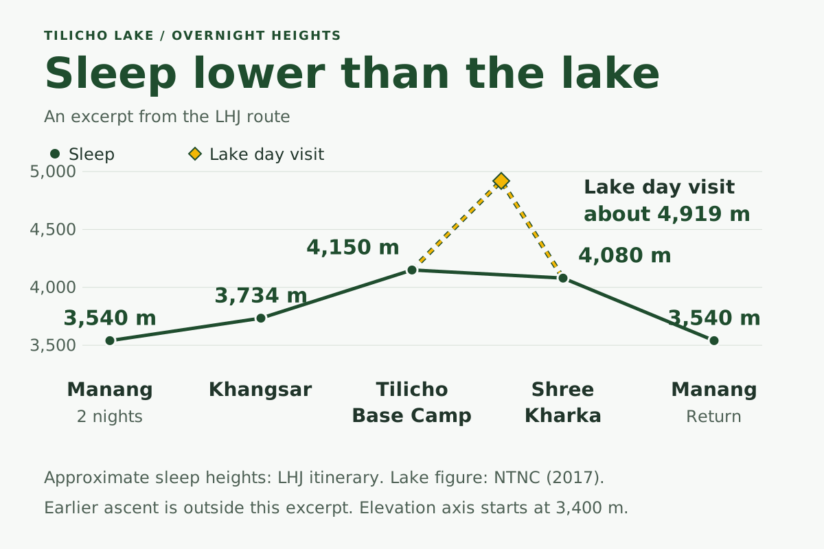
Using those planning figures, the lake is about 769 m above Base Camp. This is the net elevation difference between two places; total ascent along the walking route has not been measured here. The daytime excursion still involves effort and altitude exposure before the return to a lower bed. The earlier approach and the person's response remain part of the planning decision.
Symptoms take priority over the itinerary. CDC advises against ascending to sleep higher with altitude-illness symptoms and requires descent if symptoms worsen despite rest or treatment at the same height. Tell your guide promptly if you become unwell. Confusion, new difficulty walking or breathlessness at rest require urgent assistance and descent; do not press on to the lake. These are reasons to seek help, not a checklist for diagnosing yourself.
Which permits and guide rules need checking?
Check conservation-area entry, the published guide policy and the exact route you intend to follow. The conservation entry is commonly called the Annapurna Conservation Area Project (ACAP) permit. TIMS means Trekkers' Information Management Systems. The fee category SAARC refers to nationals of South Asian Association for Regional Cooperation member countries. A card going unchecked on someone else's trip does not establish an exemption.
| Item | What the cited authority currently publishes | What to confirm for your trip |
|---|---|---|
| Annapurna Conservation Area entry | NTNC's issuing portal lists NPR 3,000 for other foreign nationals and NPR 1,000 for SAARC nationals, tax included | Current fee, traveller category and valid entry arrangement |
| TIMS and licensed guide | NTB's TIMS page requires a licensed guide and agency-issued TIMS on listed routes, including Annapurna Circuit and Mesokanto / Tilicho Pass | Applicability to your full route and the agency's current compliance arrangement |
| Restricted-area permit | The Department of Immigration's schedule lists Manang's Narpa wards 1-5 and Nasho wards 6-7 | Whether any extension enters a listed restricted area; do not infer this from "Manang" in a trip name |
Source: NTNC's issuing portal
Source: NTB's TIMS page
Source: Department of Immigration's schedule
Confirm the TIMS arrangement before departure. LHJ's current Tilicho product FAQ says TIMS is not required or checked on the Annapurna trails; NTB's published rule still requires it on the routes in its schedule. Follow the published requirement unless a current authoritative exemption applies to your route. Ask the arranging agency to explain its compliance arrangement rather than relying on a report of an unchecked card.
For ACAP fees, use the issuing authority. NTB's general Annapurna Conservation Area overview still prints different, lower entry fees than NTNC's ePermit portal. The fee figures above follow NTNC, checked on 27 October 2026; reconfirm them before payment.
The wider Nepal trekking permits guide explains the distinctions across routes. Keep your booking discussion specific to Tilicho and any extension rather than assuming that every place in the district has the same permit arrangement.
When can you plan a visit?
Spring and autumn are the broad planning windows used by LHJ, but the lake approach needs its own condition check. NTB's Annapurna Conservation Area overview lists March-May and September-November as the region's best seasons. LHJ's Tilicho Lake Trek season guidance also uses spring and autumn, while warning that winter snow can obstruct the lake trail and upper lodges can close.
An official-source disagreement remains here too. NTB's Natural Treasures booklet recommends June-August for Tilicho while acknowledging difficult lower-approach conditions, including landslides. A regional season summary and that lake-specific recommendation are different advice; citing either one alone would hide the tension.
For practical planning, ask about the whole journey: the lower road, the loose-slope approach, snow on the lake path and which upper lodges are operating. A dry-looking upper valley does not establish that the road below it or the traverse is suitable. LHJ's Tilicho Lake Trek conditions guidance identifies monsoon landslide concerns on the lower approach and sensitivity to wet or snowy conditions below Base Camp.
There is no fixed opening calendar established by these sources. A spring or autumn booking is not a promise of an open trail, clear water or uninterrupted access. Use the Nepal trekking season guide for the wider seasonal picture, then get a Tilicho-specific update for the dates you are considering.
Return to Manang or continue on the Annapurna Circuit?
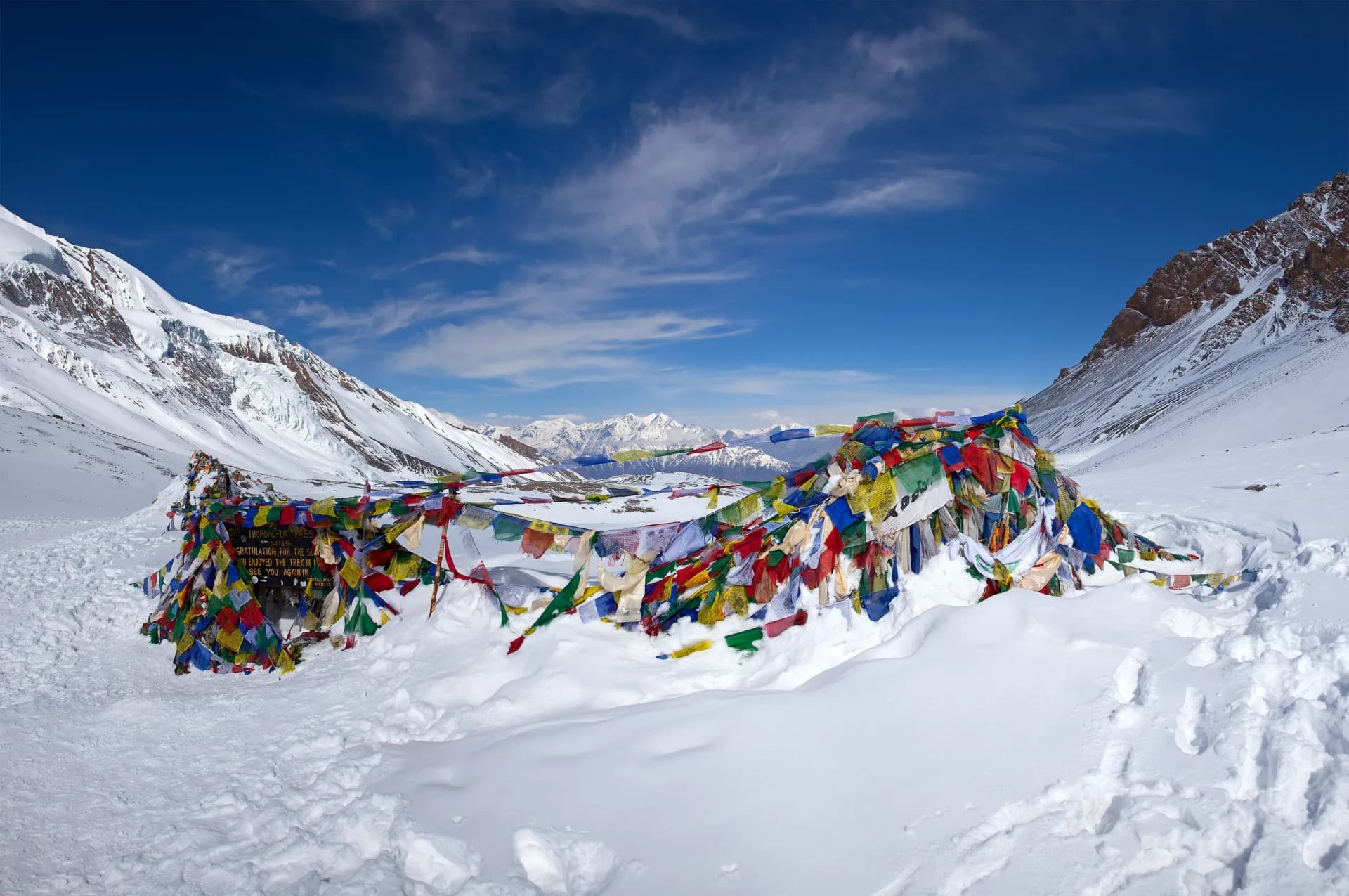
Choose the route shape before comparing durations. LHJ's standalone Tilicho trek returns down the Manang valley. Continuing on the Annapurna Circuit is a separate plan, with additional high-altitude stages toward Yak Kharka and a crossing of Thorong La Pass (about 5,416 m). The Tilicho trek page explains that distinction and directs the extension to the Annapurna Circuit trek over Thorong La.
| Your main objective | Planning direction | What to compare |
|---|---|---|
| Visit Tilicho Lake and return down the approach valley | Standalone lake-and-return trek | Lower-valley approach, overnight stops, lake day, return transport and flexibility |
| Include Tilicho within a longer pass-crossing trip | Annapurna Circuit with a separately planned Tilicho detour | Added nights, onward route, further altitude exposure and arrangements if the lake visit changes |
| Explore Manang by road | Manang Valley road trip | The actual included stops; proximity to Khangsar does not add a lake trek |
Do not read "continue on the Circuit" as a simple step from the lakeshore straight onto a pass. Ask the operator to show the onward stages and nights. Ask the guide to confirm the intended connection from the Tilicho approach to Yak Kharka. An alternative crossing from the lake basin via Mesokanto La (Tilicho Pass) is also a separate route and support decision; it is not part of LHJ's normal lake-and-return itinerary.
Travellers whose main objective is a pass crossing from Manang into Mustang can also compare the Manang to Mustang crossing trek via Thorong La. This product has its own approach and overnight plan; proximity to Tilicho does not make the lake part of it.
Tilicho is not included in LHJ's six-day Manang India road-trip itinerary. The Manang Valley product is a different trip. Reaching the valley or a road-access point nearby does not turn the lake into a spare-afternoon excursion. If Tilicho is the reason you want to visit, compare a trek designed around the lake rather than adding it to a road package by assumption.
Tilicho Lake questions
Is Tilicho Lake 4,919 m or 4,949 m high?
LHJ uses about 4,919 m as its planning figure, matching NTNC's 2017 annual report. NTB's Natural Treasures booklet gives 4,949 m. The publications do not explain the difference, so this guide retains both figures rather than claiming a surveyed resolution. Neither establishes a world-highest-lake ranking. See the height sources above.
Can you drive all the way to Tilicho Lake?
No. The lake requires a walking approach and a high excursion from Tilicho Base Camp. LHJ recorded road access toward Khangsar in August 2026, but the usable endpoint still needs a dated check for your trip. A road connection also does not determine how quickly you should gain sleeping height. See road access and the walked route.
How far is Tilicho Lake from Khangsar and Base Camp?
LHJ's published estimate is about 16 km and eight hours for the complete Base Camp, lake and Shree Kharka stage. It is not a one-way Base Camp-to-lake measurement, and the combined stage figures do not establish a precise one-way Khangsar-to-lake distance either. Ask the guide to confirm the intended endpoints, walking time and conditions. The stage table shows the full context.
Is Tilicho Lake suitable for a short trip or a beginner?
A beginner label or total day count cannot settle that decision. Compare the approach before Manang, each sleeping stop, the long lake-return day and the loose-slope crossing with your guide. Prior altitude exposure, the person's response and current conditions matter. The +416 m Khangsar-to-Base Camp sleeping step is a planning estimate, not proof of safety; the altitude section explains the differing CDC and HRA guidance.
Can you stay at Tilicho Lake itself?
Do not assume there is a lakeshore lodge. LHJ's published plan sleeps at Base Camp, visits the lake by day, then descends to sleep at Shree Kharka. Confirm the actual lodge and its opening for your departure. Overnight camping requires its own campsite, permissions, equipment and support arrangement. See overnight stops.
Do you need permits and a guide for Tilicho?
Check conservation-area entry and the published guide/TIMS requirement against your complete route. NTB's schedule includes Annapurna Circuit and Mesokanto / Tilicho Pass; a report of an unchecked card does not establish an exemption. Ask the agency to confirm compliance and whether an extension enters a restricted area. The permit section sets out the issuing-authority fees, published guide/TIMS policy and the departure checks still needed.
Which season should you choose for Tilicho Lake?
Spring and autumn are LHJ's broad planning windows. They do not guarantee an open lake path, working lodges or an uninterrupted road. NTB's regional advice and its lake booklet's monsoon recommendation differ, as explained in the season section. Obtain a departure-specific road, traverse, snow and lodge update before committing to the lake day.
Is Tilicho Lake included in the Manang road trip?
Tilicho is not included in LHJ's six-day Manang India road-trip itinerary. It needs a separately planned trek, rather than a spare-afternoon addition from a nearby road-access point. A lake-and-return trek and an Annapurna Circuit extension also have different overnight stages; compare the route choices.
Plan the next step
Before booking, ask for the current road endpoint, a night-by-night route, the proposed lower sleeping stop after the lake and what changes if the traverse or lake approach is unsuitable. Ask the agency to confirm permit arrangements and upper-lodge availability for the same departure dates. Those answers are more useful than a trip's shortest advertised duration.
For the lake-and-return option, see the Tilicho Lake Trek route and planning options. If a pass crossing is also central to your trip, compare the Annapurna Circuit route. Start with the route you actually want to walk, then allow the time and flexibility it needs.
Sources
Sources checked on 27 October 2026. Institutional publications support the geography, published policy and general altitude guidance. LHJ's itinerary supplies route-planning estimates; it does not establish current road, trail or lodge conditions. The source disagreements described in the article remain unresolved.
- NTNC Annual Report 2017, printed p.13 / PDF p.23: the 4,919 m lake figure.
- NTB, Natural Treasures of Nepal, Tilicho section: the conflicting 4,949 m figure and monsoon advice; document edition not established.
- NTNC, Annapurna Conservation Area Project: location and conservation-area context.
- NTNC ePermit portal: conservation-area entry fees from the issuing authority.
- NTB TIMS policy and route schedule: published guide and TIMS requirements.
- Department of Immigration, trekking routes and permit fees: the restricted-area schedule.
- CDC Yellow Book, High-Altitude Travel and Altitude Illness, 2026 edition, chapter dated 23 April 2025: general ascent and symptom-response guidance.
- Himalayan Rescue Association, altitude advice: the more conservative sleeping-height recommendation.
- NTB, Annapurna Conservation Area overview: regional seasons; its older fee figures are superseded here by the issuing portal.
- LHJ, Tilicho Lake Trek: route order, overnight heights, approximate stages and the product-policy statements distinguished above.
Something here out of date or wrong? Tell us and we will check it.