Last checked: 23 September 2026 at 09:00 Nepal time.
Check again: before you travel, after any new official warning, and whenever a road or trail on your route changes. This page is a dated status record, not a safety guarantee.
Hero image note: Editorial illustration. The route lines are fictional and are not evidence that any road or trek is open.
There is no honest country-wide yes or no answer to whether Nepal is safe to travel after the 26 August flood. The disaster is enormous: by 20:00 on 22 September, Nepal Police had reported 1,452 bodies recovered, while 4,718 people remained missing. At the same time, none of the four government travel advisories checked on 23 September tells travelers to avoid all of Nepal.
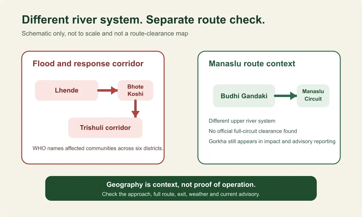
The useful question is narrower: What is the exact route, on what date, and which current sources apply to it? Almost four weeks after the flood, roads, bridges and fresh rain can still change an itinerary within hours. Manaslu lies in a different river system. After a separate 6 September disruption, local residents and authorities restored access through the affected Namrung section within days.
Key takeaways
- The flood ran down the Bhote Koshi and Trishuli rivers. Bodies have been recovered in eight districts, as far downstream as Chitwan and Nawalparasi.
- The United States says do not travel to the Rasuwagadhi-Timure-Syafrubesi area. Australia widened its warning on 8 September to flood-affected areas along both rivers in seven districts.
- The Prithvi Highway reopened at Krishnabhir on 17 September. Nepal Police's road notice current to 08:00 on 22 September no longer listed the Prithvi Highway among obstructed routes, while the Pasang Lhamu Highway and the main Rasuwa-Nuwakot highway remained listed as fully obstructed, with a rough single-lane alternative to Syafrubesi.
- On the Manaslu Circuit, local residents, the ward chair, the Manaslu Conservation Area Project and district authorities restored the affected Namrung section after a 6 September flood. The section reopened on 11 September using temporary crossings, with continued local checks advised.
What happened on 26 August 2026?
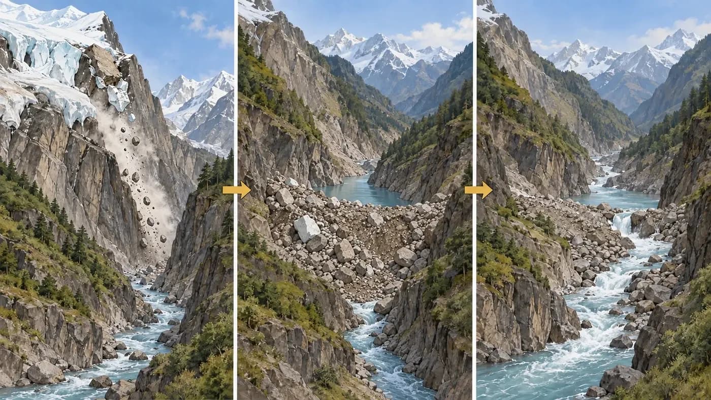
On the morning of 26 August, a surge of water, mud and rock entered Nepal at Rasuwagadhi on the Nepal-China border and ran down the Bhote Koshi and Trishuli corridor. The International Centre for Integrated Mountain Development reported that the Trishuli at Galchhi rose by as much as nine metres within 30 minutes.
Scientists have since described a glacier and rock collapse that blocked the Lhende Khola before the water broke through. The Kathmandu Post reported that satellite imagery showed a section about 600 metres wide falling from around 5,200 metres, and that a hydrologist at Nepal's Department of Hydrology and Meteorology pointed to an ice avalanche, permafrost movement and a rockslide. The same report said a full technical assessment was still pending. This update found no final official report on the cause, so the article does not present one.
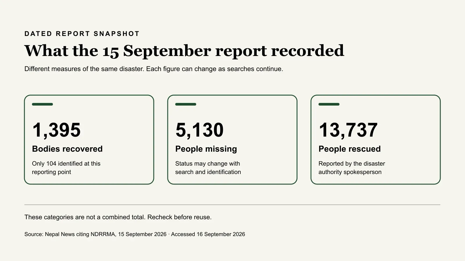
The figures are still changing. At 20:00 on 22 September, Nepal Police reported 1,452 bodies recovered. It also reported that 1,333 bodies had been managed after DNA samples were collected and that 3,345 DNA samples had been gathered from bodies and relatives. Searches continued for 4,718 people still listed as missing.
Which parts of Nepal are affected?
The best-supported answer is a set of named corridors, roads and response areas, not a green or red map of the entire country.
| Area or question | What current sources establish | What they do not establish |
|---|---|---|
| Rasuwagadhi, Timure and Syafrubesi in Rasuwa | The United States says do not travel there for any reason. Nepal Police's notice current to 08:00 on 22 September listed the Pasang Lhamu Highway and the main Rasuwa-Nuwakot highway as fully obstructed, with a rough single-lane alternative to Syafrubesi | A reopening date for the main approaches |
| Langtang, Kyanjin and Gosaikunda | The Trekking Agencies' Association of Nepal said on 11 September that the areas themselves were suitable for trekking, while Nepal Police's 22 September notice still listed the main road approaches as obstructed and identified a rough single-lane alternative to Syafrubesi | That the main road approach is restored or that the earlier trekking-area assessment still applies after fresh rain |
| Nuwakot, Dhading, Gorkha, Tanahun, Chitwan and both Nawalparasi districts | Bodies have been recovered in all of them, according to national disaster authority figures | That a whole district is closed or unsafe |
| Kathmandu to Pokhara and Chitwan by road | Two-way traffic resumed at Krishnabhir on 17 September. After one-lane restrictions were reported on 20 September, Nepal Police's obstruction list current to 08:00 on 22 September no longer named the Prithvi Highway | That the road will remain fully open on your travel date |
| The rest of Nepal | Tribhuvan International Airport is operating, and the trekking association reports Everest, Annapurna, Kanchenjunga, Makalu, Dolpo and the far west unaffected by the flood | That every road, trail and lodge is operating normally, or that the monsoon has ended |
Road sources: Radio Nepal's report of the 17 September Krishnabhir reopening, Nepal Police's road obstruction notice current to 08:00 on 22 September and the US Embassy alert of 3 September. Trekking area source: the trekking association's status of 11 September, as reported by Tourism Times. District figures: the Kathmandu Post, 12 September.
The sequence matters. Two-way traffic resumed through a new track at Krishnabhir on 17 September. Three days later, fresh rain and landslides restricted other Prithvi Highway sections to one lane. The current Nepal Police obstruction list no longer names that highway, but a dated list is still not a promise for a later journey.
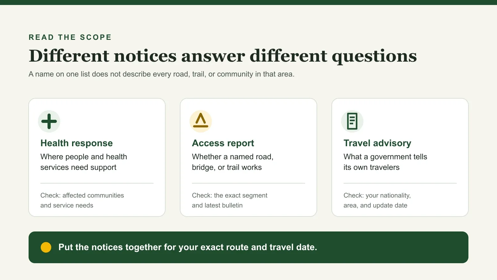
Different agencies draw different lines. The World Health Organization names six districts in its health response. The UN Flash Appeal targets 84,270 people in 17 municipalities. Recovered bodies have been counted in eight districts, and Australia's warning names seven. These are not contradictions. They measure different things.
What do current travel advisories say?
The four advisory systems below use different scales, so their labels should not be compared as if they were one global rating. Read the wording for your nationality and itinerary.
| Authority | National position, checked 23 September | Flood-specific warning |
|---|---|---|
| United States Department of State | Level 2, exercise increased caution, reissued 4 September | Do not travel to the Rasuwagadhi-Timure-Syafrubesi area of Rasuwa, including the Nepal-China border crossing |
| United Kingdom Foreign, Commonwealth and Development Office | No advice against all travel to Nepal; updated 11 September | Major flooding in Rasuwa and the Nepal-China border area caused widespread damage; Gorkha, Nuwakot and Dhading were also affected |
| Australian Smartraveller | Exercise a high degree of caution; updated 8 September | Reconsider your need to travel to flood-affected areas near the Bhote Koshi and Trishuli rivers in Rasuwa, Nuwakot, Dhading, Chitawan, Tanahu, Nawalpur and Gorkha. Postpone overland travel between Nepal and Tibet, including Kailash circuits |
| Government of Canada | Exercise a high degree of caution; page last modified 17 September | Avoid non-essential travel to Rasuwa and Nuwakot. Debris and unstable slopes could trigger further flooding in Rasuwa, Nuwakot, Dhading and Gorkha |
Advisory table sources: United States Department of State; United Kingdom Foreign, Commonwealth and Development Office; Australian Smartraveller; and Government of Canada. Check the current issue date and wording for your nationality and itinerary.
Indian travelers do not have a separate flood advisory in the Indian government sources reviewed. The Embassy of India in Kathmandu has published flood helplines for Indian nationals and their families.
Nepal's government has said the country remains open. At a briefing on 29 August, the Ministry of Foreign Affairs said areas outside the disaster continue to operate normally, Tourism Times reported. The tourism ministry has since launched a #NepalCalling campaign to counter cancellations. That is useful context, but it does not replace the warning issued by your own government or a same-day check of your road and trail.
Manaslu recovery and current route readiness
The Manaslu Circuit follows the Budhi Gandaki, not the Bhote Koshi. After a separate 6 September disruption at Namrung, the response was fast and locally led: residents, local representatives, conservation teams and district authorities restored access through the affected section within five days.
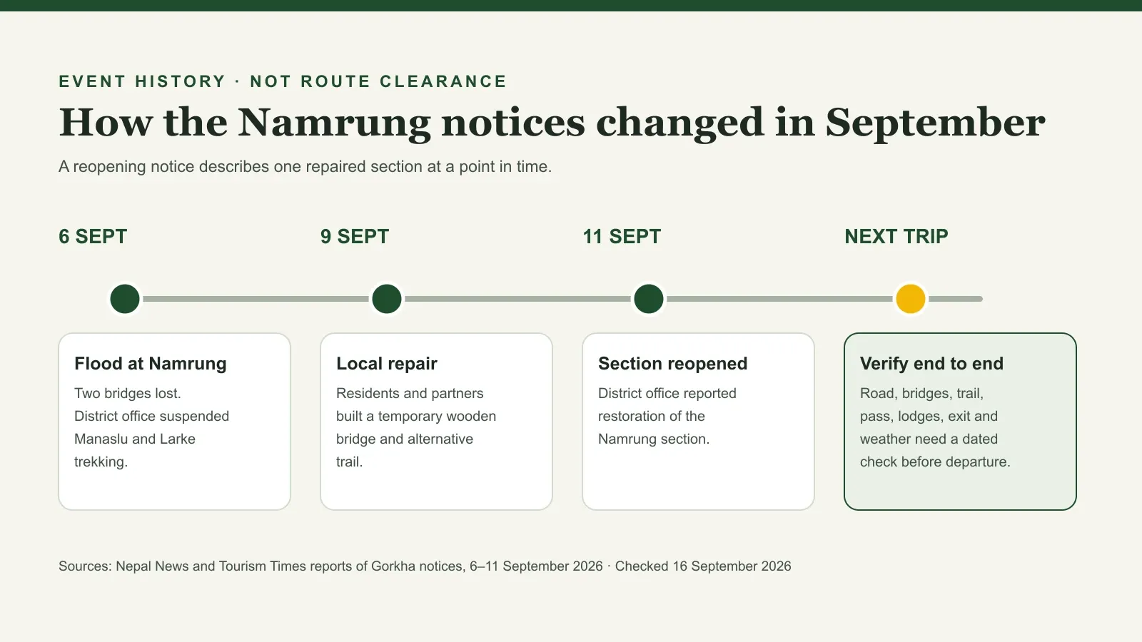
For the record, at about 3:30 that morning, a flood on the Therang Khola at Namrung in Chumnubri Rural Municipality washed away an iron bridge, a suspension bridge on the route towards Namrung forest and four houses. Nobody was killed, Nepal News reported, citing the District Police Office. An assistant chief district officer said debris had briefly dammed the stream near its source before bursting. This is the event the local recovery work addressed.
The official record shows both the disruption and the response:
- 6 September: The District Administration Office in Gorkha told trekkers not to start or continue Manaslu and Larke Pass journeys until further notice, Tourism Times reported. A landslide also blocked the Tsum Valley trail at Chaurikharka.
- 9 September: Residents, the ward chair and the Manaslu Conservation Area Project built a wooden bridge and an alternative trail at Therang Khola, according to the rural municipality. Explorersweb reported that the crossing was built quickly and that the district's postponement advice still applied on 9 September.
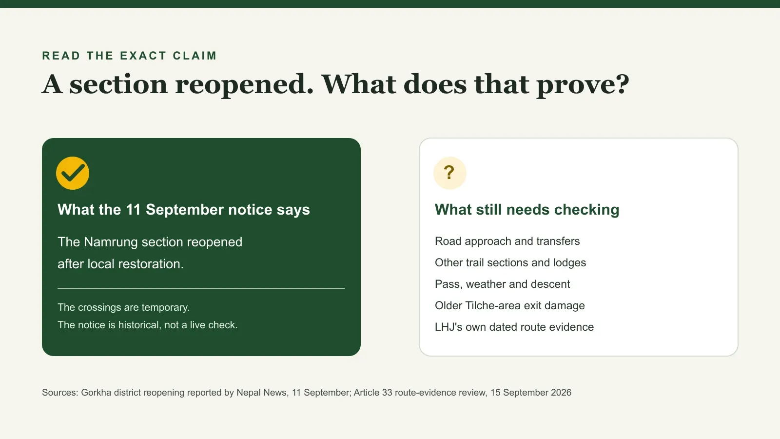
- 11 September: The District Administration Office said the Namrung section had reopened after restoration and lifted its restriction, Nepal News reported. Trekkers were told to stay updated on local conditions.
- 11 September: The trekking association's safety status said the Ghap-Namrung section had reopened on two wooden bridges and the Chaurikharka blockage was repaired. It advised trekkers not to ride horses or mules in the area.
Two earlier access notices provide additional route context. On 10 August the trekking association warned against the Dharapani-Larke section after damage near Tilche and the loss of the Surkhi Khola bridge. This review did not locate a later public repair update. For the road approach, after the Malekhu bridge collapse, the association published alternative approaches to Arughat through Galchhi and Sunaulabazaar or through Benighat.
Manaslu remains one of the Great Himalayan Walk regions. Applications and trip planning can continue while LHJ completes a dated route check for the chosen departure. That check combines the recovery already reported with current confirmation of each section:
| Section | Latest public status | LHJ pre-departure check |
|---|---|---|
| Kathmandu to Machha Khola | Alternative approaches via Galchhi or Benighat to Arughat were published after the Malekhu-Dhadingbesi bridge closure (11 September) | Same-day road, bridge and vehicle status for the selected approach |
| Machha Khola to Jagat | No disruption specific to this section was identified in the sources reviewed | Named local or guide confirmation of the trail, bridges and lodges |
| Jagat to Namrung and Samagaun | Local crossings were established and the affected section reopened on 11 September after the 6 September bridge damage | Condition of the restored crossings after any further heavy rain |
| Samdo and Larkya La | The trekking association listed the Larke Pass area as unaffected (11 September) | Pass, snow, weather and descent conditions on the day |
| Bimthang to Dharapani | A 10 August notice recorded damage near Tilche and Surkhi Khola; a later public repair update was not located in this review | Current local confirmation of the section and crossing |
| Weather and flood alerts | DHM forecast increasing rainfall from 23 September, with heavy to very heavy rain possible in parts of Gandaki and Lumbini from 25 to 27 September and extremely heavy rain possible at isolated locations | The current Department of Hydrology and Meteorology bulletin and local confirmation for the departure dates |
The live Manaslu Circuit Trek page explains the itinerary and route demands, and the Manaslu region overview gives wider context. The Nepal trekking permits guide explains the restricted-area permit and guide rules. LHJ pairs this evergreen information with current local checks before confirming a departure.
What should booked travelers do now?
Use this order. It avoids both panic cancellation and false reassurance.
- Write down the exact route and dates. Include every road transfer, trail section, bridge, overnight stop and exit point.
- Read the official advice for your nationality. Check the latest issue date and whether the warning names your corridor, district or border crossing.
- Ask the provider for current evidence. A useful answer names the road, trail section, local contact, check time and next review.
The region is fineis not enough, and neither is a reopening notice from last week. - Check transport and insurance separately. The airport can be operating while the highway is closed. Insurance may treat cancellation, interruption, trekking altitude and official warnings differently.
- Keep the decision reversible. Allow buffer days for road closures and understand the change, postponement and cancellation terms before paying or departing.
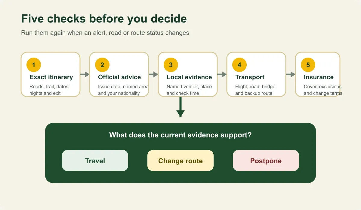
Refresh the decision when a route, weather warning or official advisory changes. For LHJ's broader risk approach, see how trek safety is handled.
If you are already in Nepal, follow instructions from local authorities. Stay away from riverbanks, damaged bridges and unstable slopes, and do not enter the affected area to search for someone. The US Embassy gives the same advice.
Relief and responsible travel can coexist
Emergency relief and tourism do different jobs. One should not be used to diminish the other.
For urgent support, Nepal's Ministry of Foreign Affairs directs donations to the Prime Minister's Disaster Relief Fund. The UN appeal for the humanitarian response seeks US$49.6 million to the end of December and does not cover reconstruction, according to its 8 September situation report. Check the destination of any donation directly.
Travel spending can pay the guide, porter, driver, lodge, restaurant and supplier involved in a real trip. The Pacific Asia Travel Association has asked travelers and businesses to tell affected corridors apart from the rest of the country. That is a fair request, but one booking does not rebuild a disaster-affected community. If Nepal is already in your plans, keep or change the trip according to current route evidence and local advice, not guilt.
The practical principle is simple: support relief where it is needed, and travel only where current checks support the itinerary.
Update and correction record
| Checked | What changed |
|---|---|
| 1 September 2026, 08:57 NPT | Initial version: WHO six-district footprint; four government advisories; Manaslu described as outside the main flood corridor; no LHJ operating claim |
| 15 September 2026, 09:00 NPT | Added official death and missing figures and the scientific description of the cause; Australia's widened warning; closures on the Prithvi and Pasang Lhamu highways; the trekking association's route status; the 6 September Namrung flood, the Manaslu suspension and the 11 September reopening; the Malekhu bridge collapse on the Manaslu road approach |
| 20 September 2026, 23:45 NPT | Updated the reported recovery figure; recorded the 17 September Krishnabhir reopening and the 20 September single-lane restrictions on other Prithvi Highway sections; refreshed the Pasang Lhamu and Rasuwa road status, weather note and four foreign advisories |
| 23 September 2026, 09:00 NPT | Refreshed the Nepal Police recovery figures and road obstruction notice; rechecked the four foreign advisories; added the 25-27 September Gandaki and Lumbini rainfall outlook; retained the Manaslu recovery framing and route-specific departure checks |
Changing information was checked against Nepal Police and disaster-authority reporting, the District Administration Office in Gorkha as reported by Nepal News and Tourism Times, WHO, UN OCHA, ICIMOD, the Trekking Agencies' Association of Nepal, and official United States, United Kingdom, Australian and Canadian travel advice.
If a source, road, warning or route status changes, this page is corrected with a new check time and a short note naming the changed fact and its source.
Frequently asked questions
Is Nepal closed to tourists after the August 2026 flood?
No. None of the four government advisories checked on 23 September advises against all travel to Nepal, and Nepal's government says areas outside the disaster remain open. The United States says do not travel to the Rasuwagadhi-Timure-Syafrubesi area, Australia says reconsider your need to travel to flood-affected areas in seven districts, and Canada advises against non-essential travel to Rasuwa and Nuwakot. Major roads outside those areas can still be closed or restricted.
How many people died in the flood?
At 20:00 on 22 September, Nepal Police reported 1,452 bodies recovered and 4,718 people still missing. The figures change as search and identification continue.
Should I cancel my Nepal trip?
Do not decide from a national headline alone. Compare your exact route and dates with the latest official advice, road status, your provider's local evidence, insurance terms and available alternatives. Postpone or change the trip when those checks do not support it.
What is the current Manaslu Circuit status?
Local residents, the ward chair, the Manaslu Conservation Area Project and district authorities restored access through the Namrung section after the 6 September flood. Gorkha's District Administration Office reported the section reopened on 11 September using temporary crossings. Earlier notices about the Dharapani-Larke side and the road approach remain part of LHJ's pre-departure check, so applications and planning can continue while the exact route is confirmed for each travel date.
Does visiting Nepal support recovery?
Travel pays the businesses and workers involved in the trip, but it does not replace emergency relief and should not be presented as a guaranteed recovery contribution. Use verified relief channels for donations and make travel decisions from current route evidence.
Something here out of date or wrong? Tell us and we will check it.